The world has many “archipelagos,” such as the Philippines, Japan, Cuba, and the Maldives, but few can be called “the land of thousands of islands.” Indonesia is one of them, boasting over 17,500 islands, making it the largest archipelago nation in the world.
However, what’s even more astonishing about this country is the number of volcanoes. Located along the Pacific Ring of Fire, Indonesia sits at the intersection of the Eurasian, Pacific, and Indian Ocean plates, making it the country with the most volcanoes and the highest volcanic activity in the world. There are over 400 volcanoes in total, with 120 of them being active, accounting for about one-sixth of the world’s active volcanoes.
This map shows the distribution of volcanoes, most of which are arranged in a band running from east to west across Sumatra, Java, and the Lesser Sunda Islands.
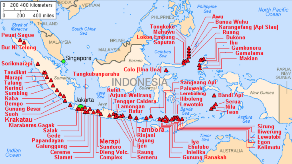
Indonesia has 14 volcanoes that exceed 3,000 meters in height:
- Kerinci (3,805m) – Gunung Kerinci
- Rinjani (3,726m) – Gunung Rinjani
- Semeru (3,676m) – Gunung Semeru
- Slamet (3,432m) – Gunung Slamet
- Sumbing (3,371m) – Gunung Sumbing
- Arjuno-Welirang (3,339m) – Gunung Arjuno
- Raung (3,332m) – Gunung Raung
- Lawu (3,265m) – Gunung Lawu
- Dempo (3,173m) – Gunung Dempo
- Merbabu (3,145m) – Gunung Merbabu
- Agung (3,142m) – Gunung Agung
- Sindoro/Sundoro (3,136m) – Gunung Sindoro
- Iyang-Argapura/Argapuro (3,088m)
- Cereme/Ciremai (3,078m) – Gunung Cereme
About Lombok Island
It’s well known that Bali, a famous tourist destination in Indonesia, is often dubbed a place you can visit over and over again. However, few people realize that just across the strait lies another stunning island—Lombok. To put it simply, if Bali is a dazzling pearl, then Lombok is a rough-hewn gemstone, radiating an unrefined beauty. Known as the “back garden of European travelers,” Lombok is nearly the same size as Bali, featuring beautiful beaches and steep volcanoes. Yet, its level of development is far lower than that of Bali, making for a more rustic and laid-back experience.
Lombok Island is mainly divided into three regions:
On the west side is the largest city, Mataram, next to the tourist hub of Senggigi Beach. A bit further north are the three Gili Islands—Gili Air, Gili Meno, and Gili Trawangan. All three are great for vacations: Gili Air is the closest to Lombok and has deeper waters, making it ideal for diving; Gili Meno is the smallest of the islands; and Gili Trawangan, the farthest, is the largest.
To the south lies a region with various towns and villages, where Lombok International Airport is located.
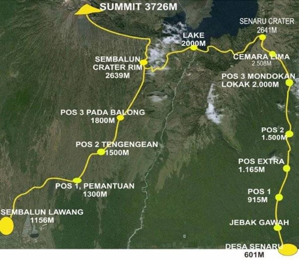
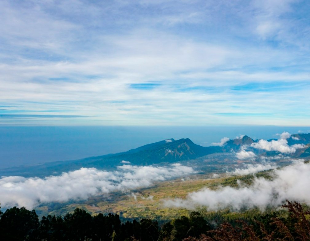
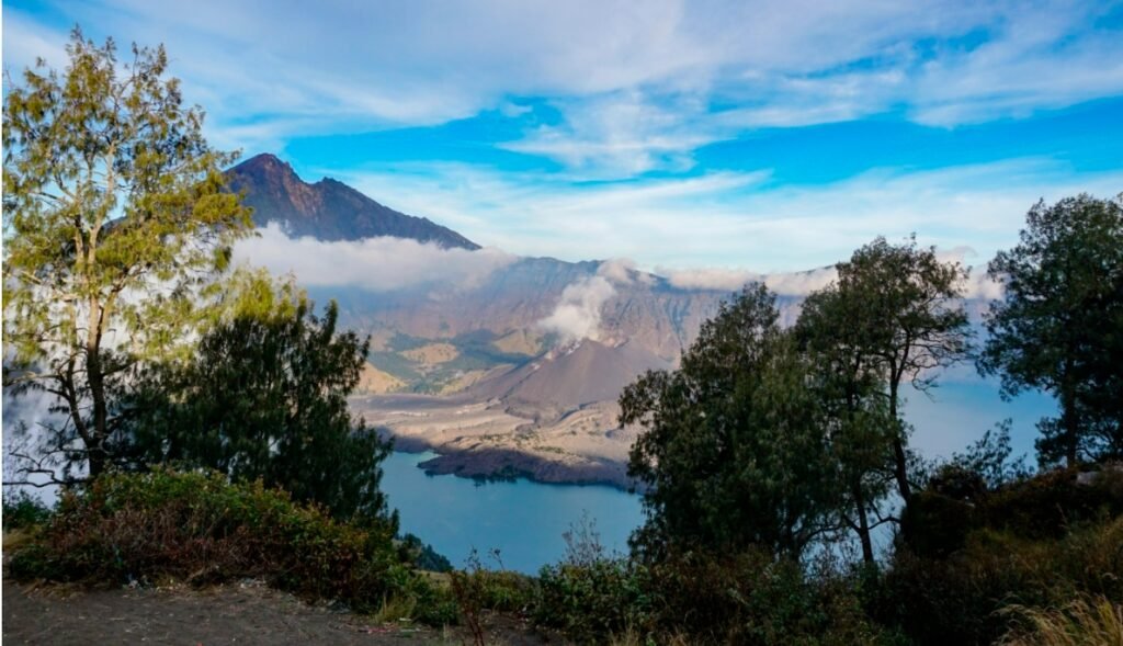
In the north stands the famous Rinjani Volcano, also known as Gunung Rinjani. This active volcano, with an elevation of 3,726 meters, is connected by three crater lakes. The trekking route here has been ranked among the 45 best scenic hiking trails in the world, attracting many travelers from afar to witness its beauty. The two villages at the northern and northwest base, Senaru and Sembalun, serve as starting or ending points for hikes, with most trekking companies offering routes that start in Sembalun and end in Senaru.
Best Time to Visit
Lombok Island is located near the equator and has a tropical rainforest climate, with an average temperature of around 28 degrees Celsius. There are no extreme cold temperatures, but it doesn’t get excessively hot either. The year has distinct wet and dry seasons. From November to February and from May to October, rainfall is relatively low, making this the prime time for tourism, especially for trekking on Rinjani Volcano. During the rainy season, heavy downpours can occur, significantly increasing the difficulty of hikes. If you’re planning to trek Rinjani, it’s best to avoid the rainy season.
Gili Islands
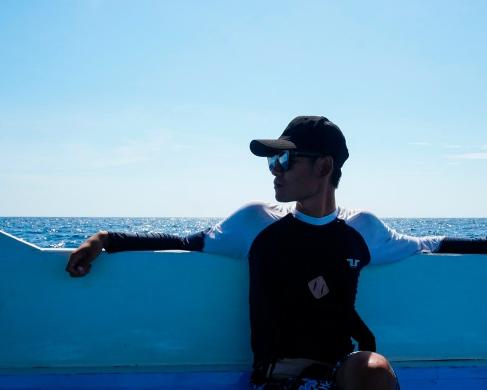
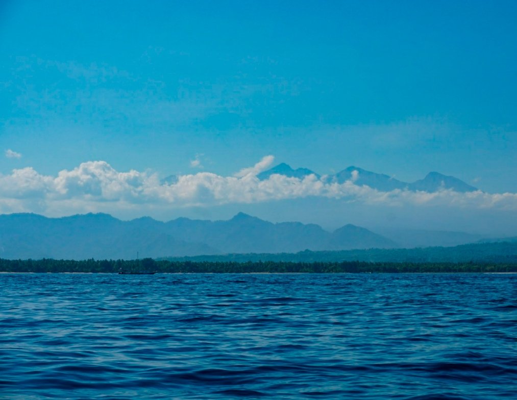
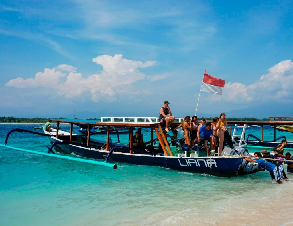
Our first itinerary on Lombok Island was a day trip for snorkeling at the Gili Islands. We hired a car and a boat, starting with a ride from our hotel to the harbor. Once on the water, we were treated to stunning views of the towering volcano in the distance, which looked almost like a mirage. Below are our charming guide and captain, who took great care of us throughout the day. They adjusted the itinerary based on our needs, making everything feel very flexible and free.
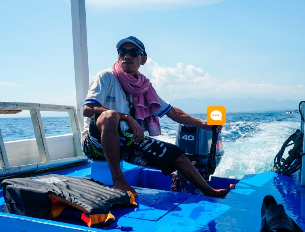
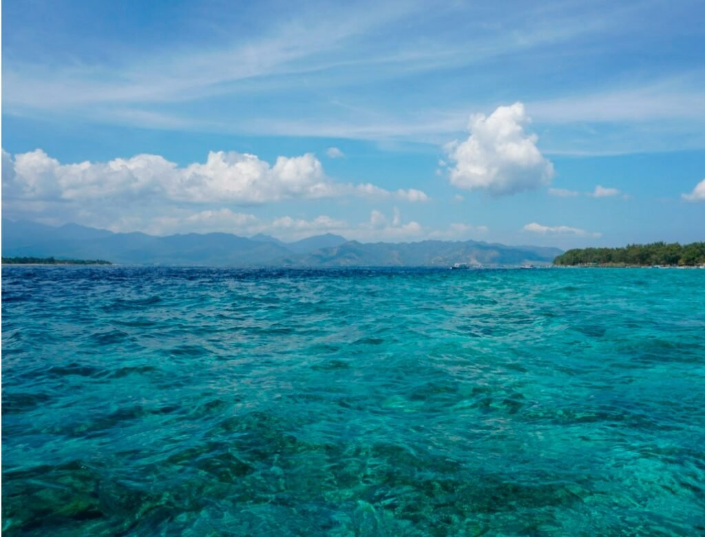
After about an hour on the boat, we arrived around the Gili Islands. Our first stop was a snorkeling spot, and the water was incredibly clear. The colors of the sea weren’t just the usual deep blue; it had a unique tropical jelly-like hue, sparkling in the sunlight. From the boat, we could see the underwater world in vivid detail. The captain found a spot where sea turtles were known to appear, and he started circling the area to look for them.
We got ready with our masks and snorkels, and then we heard the captain excitedly shout, “Turtle, turtle!” Following his direction, we spotted a sea turtle at the surface, taking a breath. Through the crystal-clear water, we could see its large head popping up. We were all thrilled and couldn’t wait to jump in and chase after the turtle!
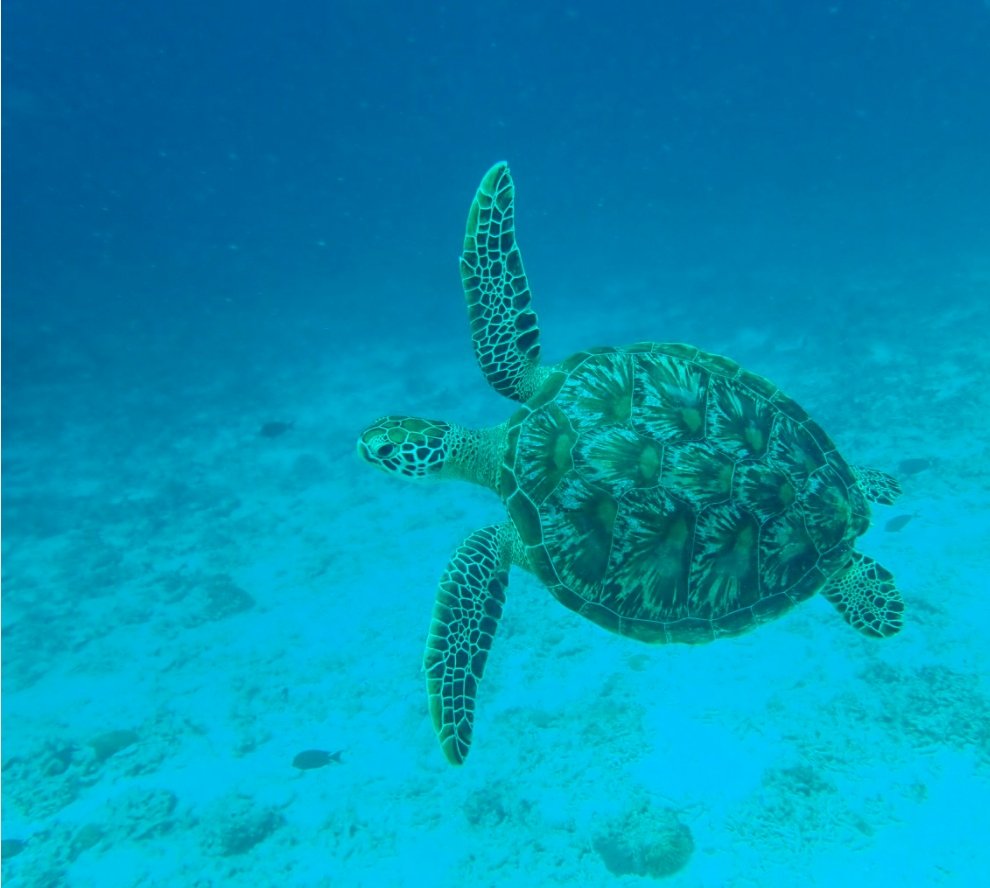
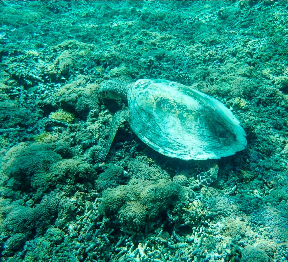
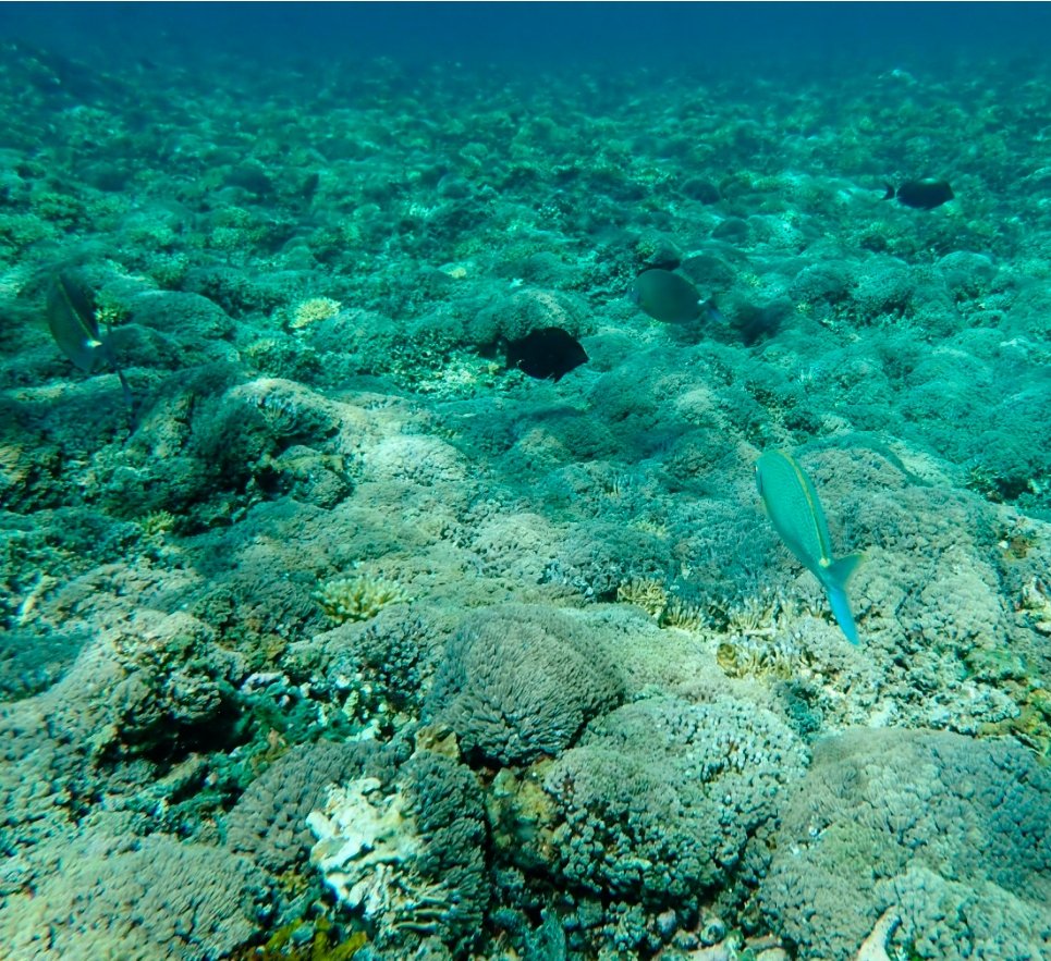
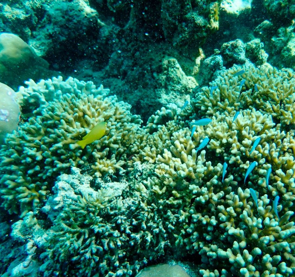
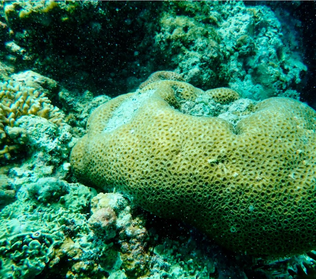
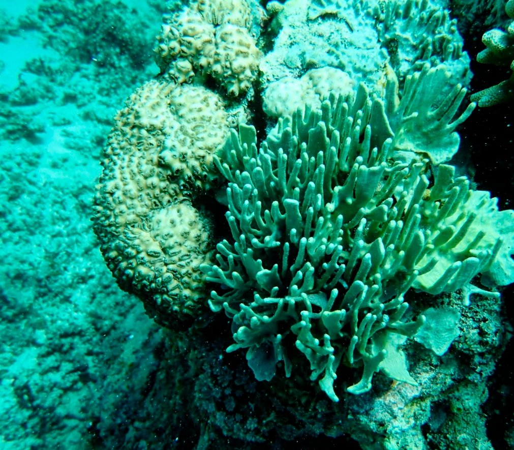
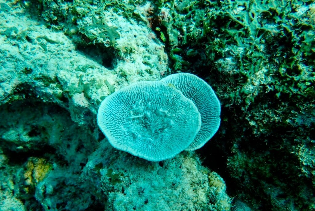
The underwater world was not just about the sea turtles. There were vast stretches of vibrant, multicolored coral reefs and schools of various fish swimming gracefully around us. Even though I’ve visited many islands and seen the seas in different parts of the world, nature always has a way of surprising you. Every dive brings something new and unexpected. I was truly amazed by the richness and diversity of the underwater world in the Indian Ocean!
On Lombok Island, you’ll find plenty of these boats with supporting arms on either side, resembling the claws of a walking crab. In Southeast Asian island countries, they’re commonly referred to as “crab boats.”
With the sea often choppy, these crab boats are designed to maintain stability during the journey. Thanks to their unique shape, they don’t sway much, making them a great choice for those who are prone to seasickness.
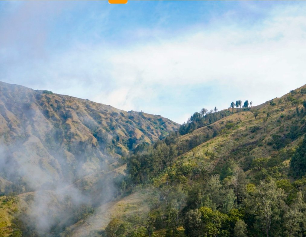
Rinjani Volcano
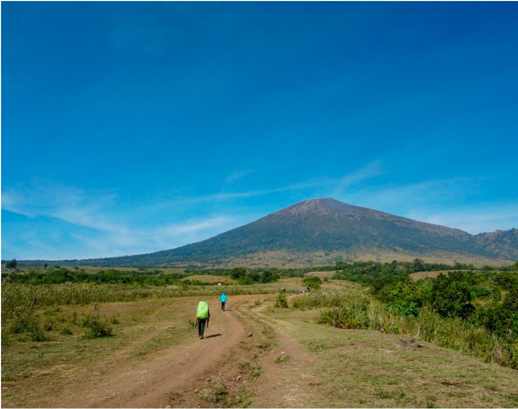
Next up on our Lombok itinerary—and the highlight of the trip—is Rinjani Volcano. First, we’ll drive to Sembalun village, located at the foot of the volcano. Once we arrive at this simple bungalow, our guide will handle all the necessary paperwork, and then we’ll officially kick off our hike!
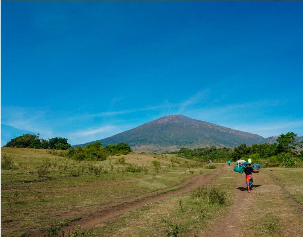
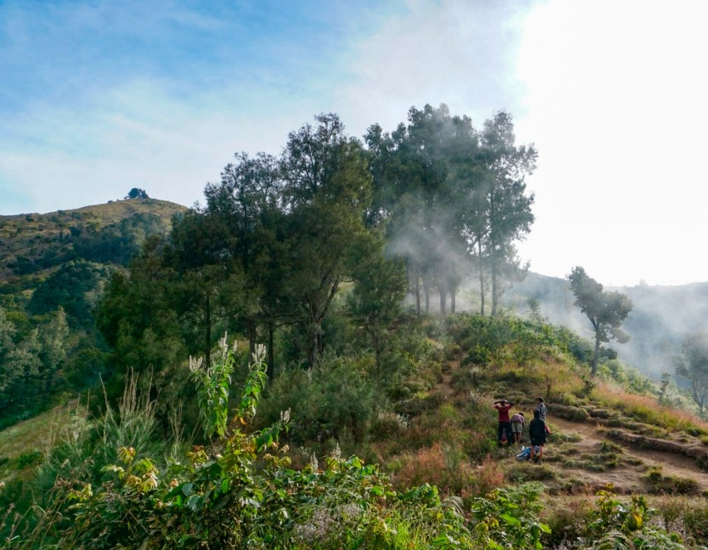
Do you see the porters ahead? Along the hiking trail, we encountered many porters carrying two large baskets suspended from a bamboo pole. These baskets were filled with camping gear and supplies, including all the food for the trekkers over the next few days. The porters, wearing headscarves and flip-flops, moved swiftly, navigating the trail with ease. They were much faster than us tourists, who were traveling light!
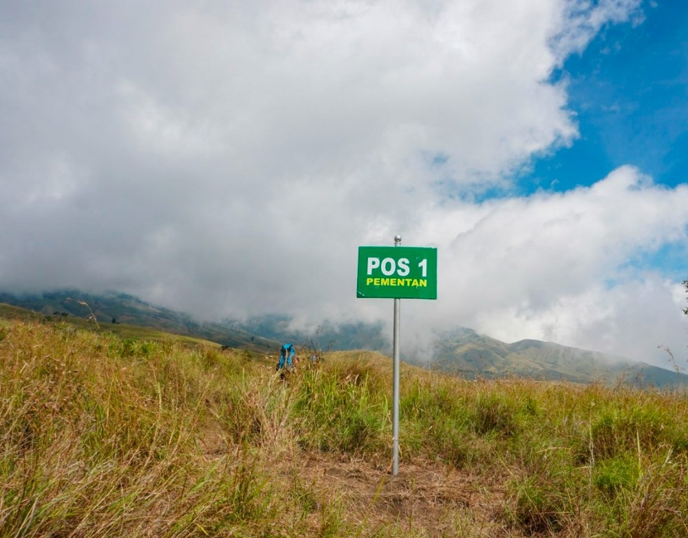
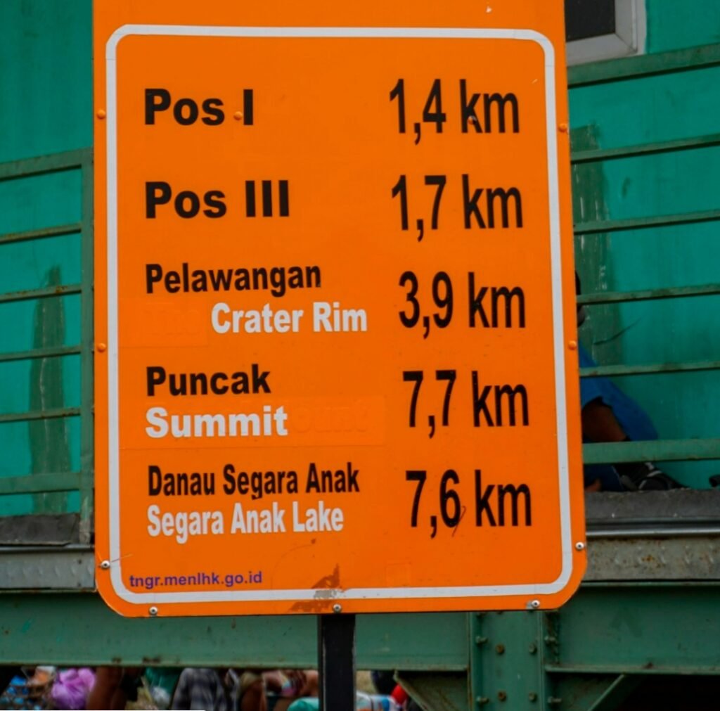
After about an hour of hiking, we reached the first rest point, POS1. By this time, our clothes were completely soaked with sweat. Next to the gazebo, there was a little stall selling frozen drinks. We took a 15-minute break, enjoyed some chocolate, and replenished our hydration before continuing on our journey.
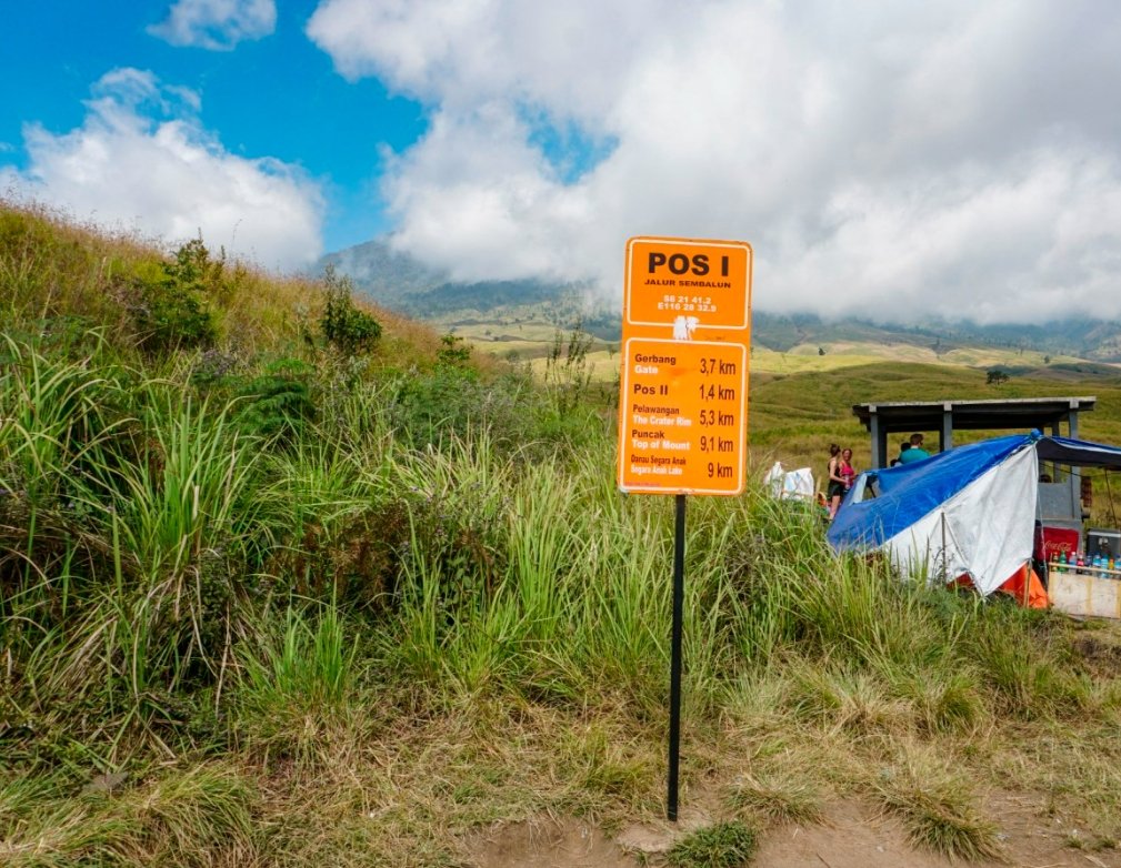
Leaving POS1, it took us about half an hour of hiking to reach the next rest point, POS2. This is the largest rest area along the trail and the furthest point that can be reached by motorcycle. Here, there’s also a small shop offering frozen drinks. From this point onward, all supplies have to be carried up by human shoulders.
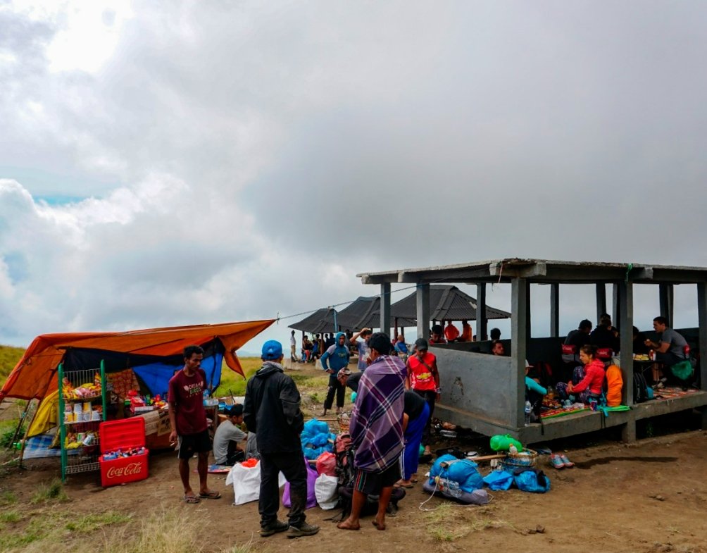
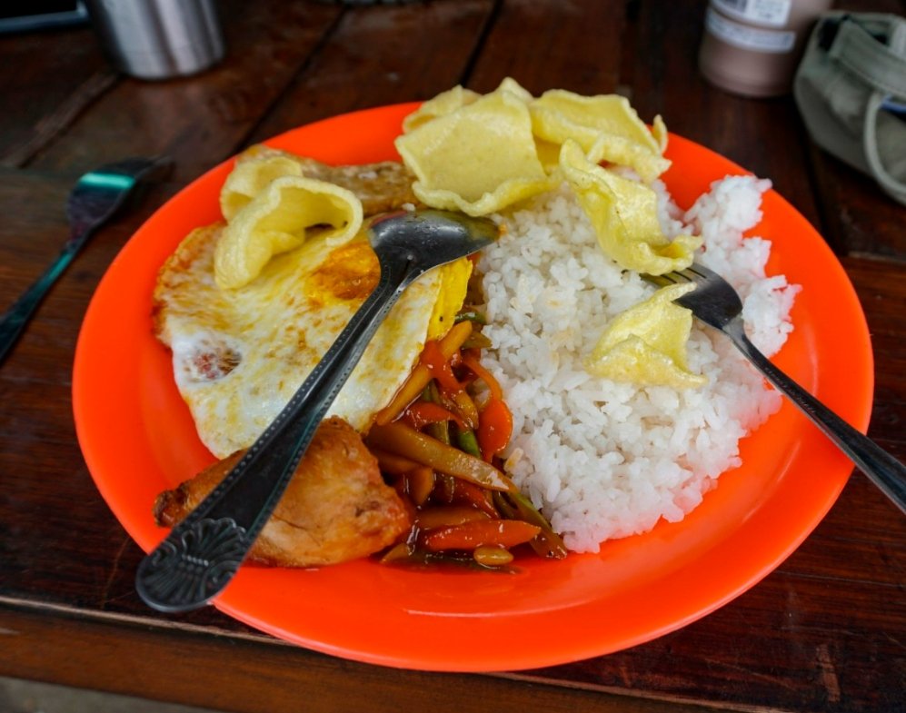
When we arrived at POS2, our guide and the porters had already been there for a while. While we rested, they prepared lunch for us, and when the food was served, we were all taken aback—it was rice topped with delicious dishes! In such a remote place, we had rice, vegetables, and even eggs! Our guide instantly seemed larger than life in our eyes.
Not only that, but soon after, he brought out five cups and poured hot tea for us, even adding sugar to each cup. Then came a plate of pineapple and five bottles of energy drinks. I felt a mix of admiration and gratitude. Honestly, I was expecting to just make do with whatever we could find on the mountain, but this exceeded all my expectations.
Even though we had paid for these services, I was still touched by the thoughtfulness of the climbing company. They not only provided fruit and energy drinks but also hot tea with sugar. The porters, who took the same route as us, always arrived early to prepare our meals. I can still vividly recall our guide in his orange shirt, carefully adding sugar to each cup of hot tea and stirring it in. This was the first time I truly felt such a heartfelt and moving level of service.
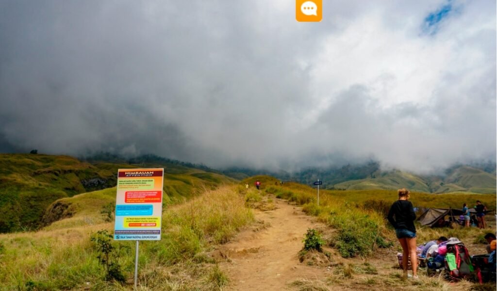
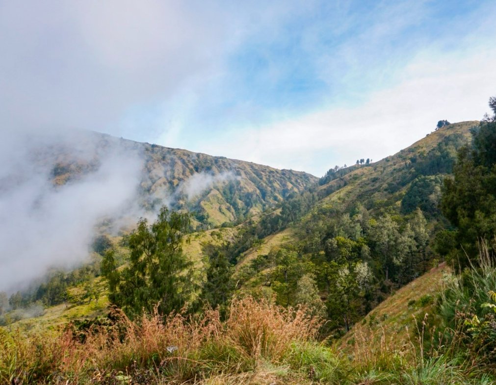
In the afternoon, clouds began to roll in, obscuring the volcano from our view, and the sunlight grew less intense. Feeling full and refreshed, we continued our ascent. Leaving POS2 behind, we said goodbye to the flat meadows and were now on this kind of rugged mountain trail.
As we gained elevation, the terrain became increasingly unique, with occasional signs of past lava flows. The views were absolutely stunning; although it was a mountain, it was unlike any I had seen before. The undulations, ravines, cracks, and vegetation filled me with wonder. Even though I was tired, I couldn’t resist looking around and taking photos.
As we got closer to the cloud layer we had seen from the mountain below, the clouds transformed into swirling mist right before our eyes. They were quickly swept along by the wind, sometimes parting to reveal the blue sky, only to regroup and envelop us once more.
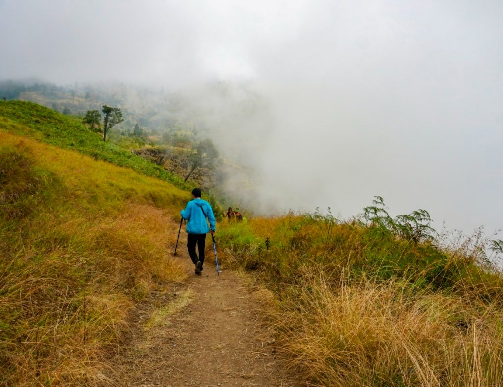
At this point, the trail was getting increasingly difficult to navigate. The sun peeked out at times, only to be shrouded again, and every time it emerged, I felt a complex mix of emotions—mostly numbness. While the cool mist was refreshing, it also obscured any sense of direction. You could never see how far you still had to go to reach the next possible destination. The only option was to keep following those around you. Everyone was exhausted, and there was no urge to chat; it was just a matter of climbing, resting, and then climbing some more.
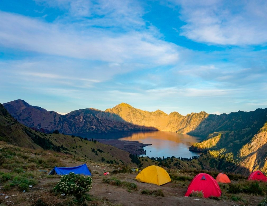
I couldn’t tell how long we had been walking, but we were getting close to our campsite at Sembalun Crater Rim (2639m). Suddenly, I glanced back and realized just how high we had climbed. It was a little awe-inspiring to think that we had started from the foot of the mountain and reached this point all in one day. I silently gave myself a pat on the back for the achievement.
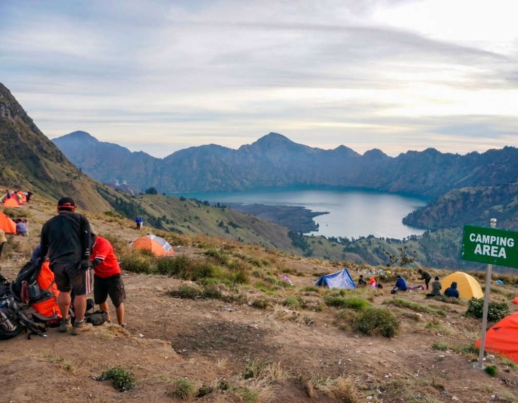
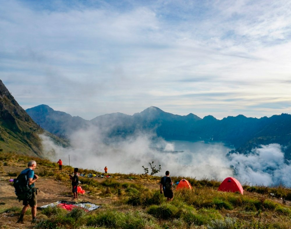
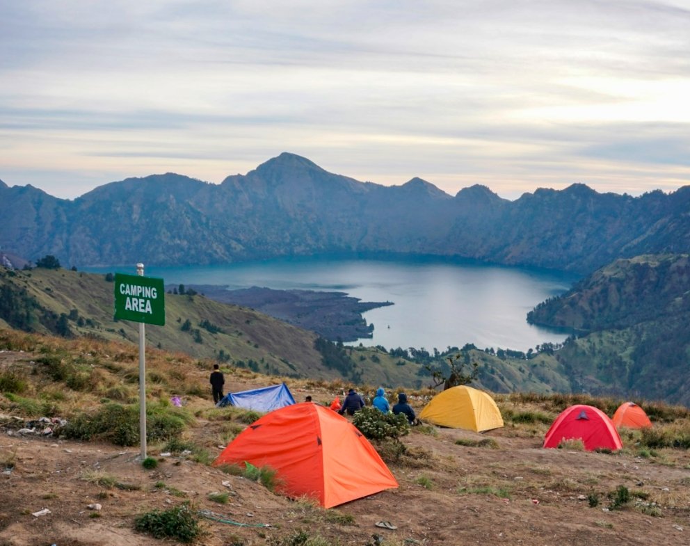
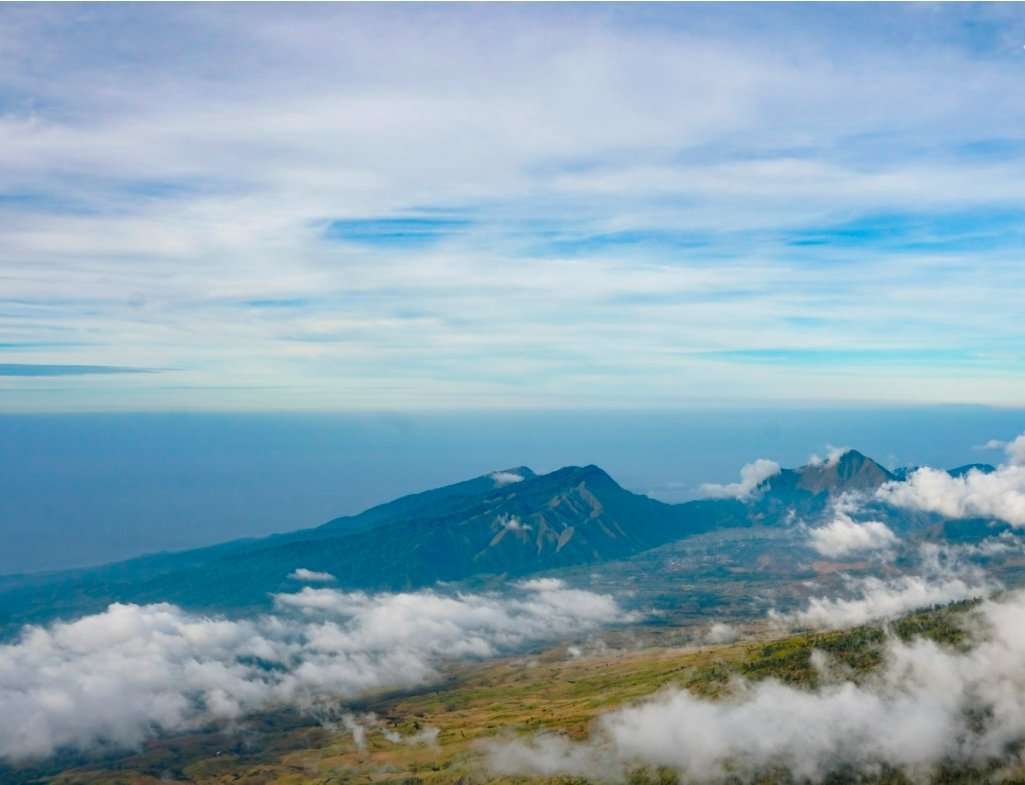
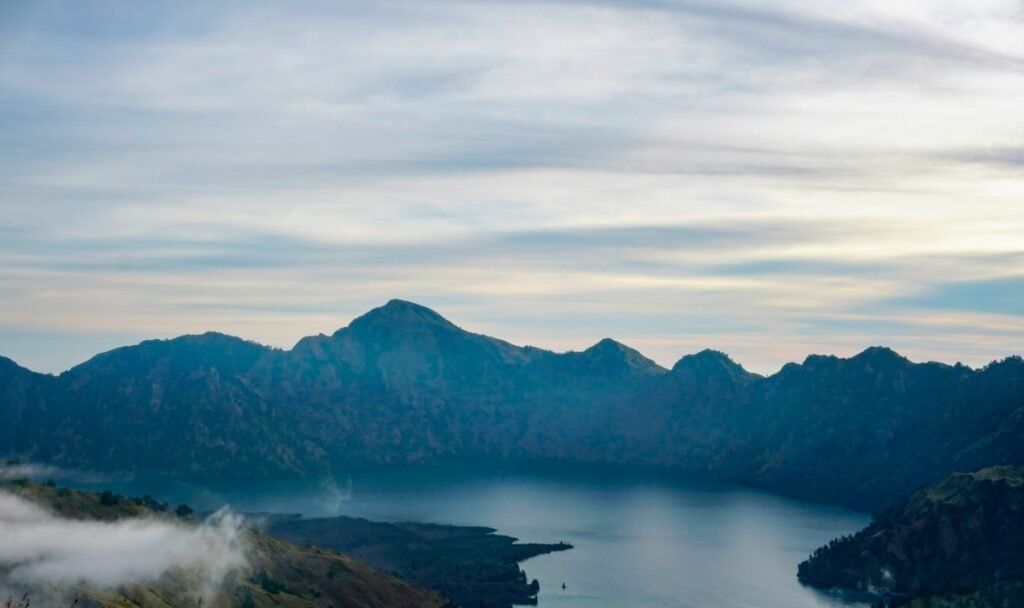
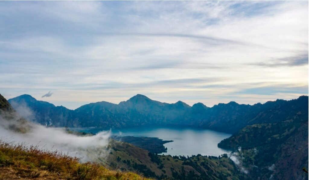
I held my breath, and we finally arrived at tonight’s campsite. The view opened up before us; the clouds lay beneath us, and the volcanic lake was right in front.
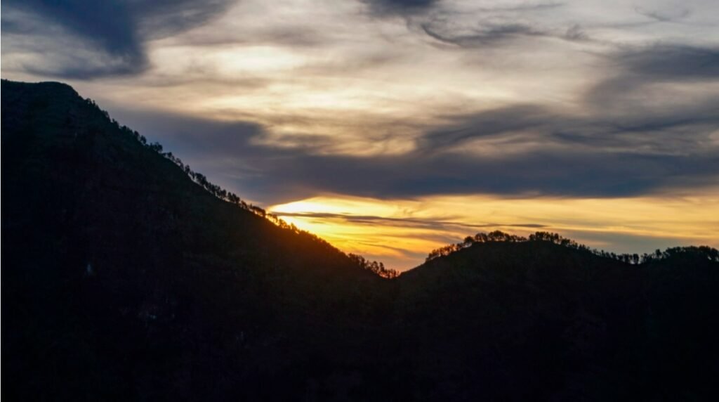
When we arrived, the porters had already set up our tents and even brought chairs up the mountain—truly incredible! As the temperature dropped sharply in the evening, we put on our down jackets and thought how perfect it would be to have a cup of hot water. To our surprise, the guide brought us two cups of hot chocolate. Life has a way of offering unexpected warmth and endless hope. Sitting in our chairs, sipping hot chocolate while enjoying the spectacular sunset over the sea of clouds was an experience that far exceeded our expectations.
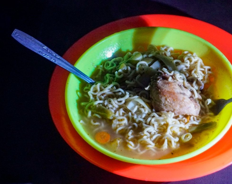
After watching the sunset, we returned to our tents to wait for dinner prepared by our guides. The meal was chicken noodles—simple, but having a hot bowl of soup at such high altitude felt like a great luxury. As night fell, the temperature on the mountain dropped significantly, prompting most people to crawl into their sleeping bags inside the tents. For those with a cleanliness obsession, it’s best to bring your own sleeping bag, as the ones carried up by the porters are likely to have been used by others before and might not be that clean.
Due to the strenuous activity of the first day, we decided to forgo our plan to rise early and summit the volcano. Instead, we slept until we naturally woke up. As the sun began to illuminate the opposite mountain, we noticed that the teams that had set off at dawn to reach the summit had yet to descend.
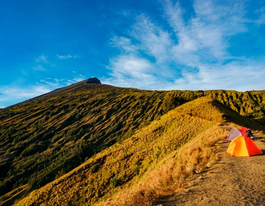
The path ahead is the route to the summit, and it looks quite flat—nothing like the terrifying descriptions we had heard. However, our guide warned us that despite its appearance, the ridge is covered in loose volcanic rocks, making it difficult to move quickly. From this point to the summit, there’s still an ascent of another 1,100 meters. It’s said that only about 30% of climbers manage to reach the top before sunrise. Given our physical condition, attempting to summit would be quite challenging, so it seems we made a wise choice to forgo that plan.

I thought yesterday’s journey had been incredibly challenging, but each subsequent stretch of the trek proved to be just as tough. Now we had to descend from about 2,700 meters to the volcanic lake at 2,000 meters. Although it was only a 700-meter drop, the journey was quite lengthy, especially along the winding mountain paths.
The first part of the descent was particularly grueling; it was no longer a path but a series of irregular rocks we had to navigate. The other side was a sheer drop. Exhaustion was one thing, but my knees began to ache with each step downward, making progress even slower.
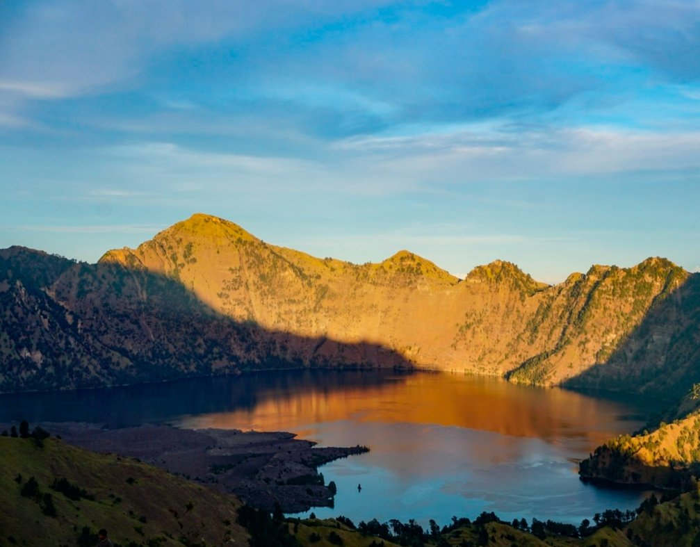
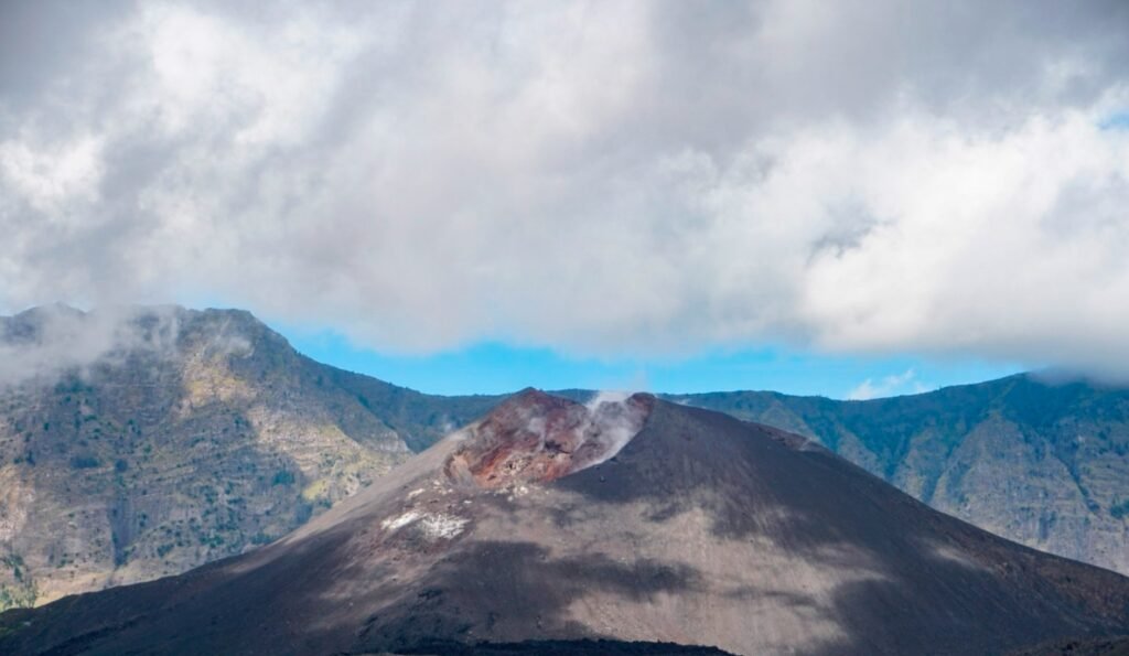
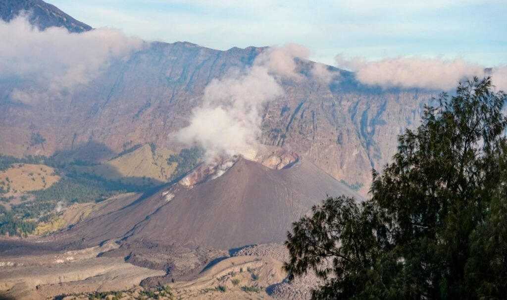
After five hours of laborious trekking, we finally reached the edge of the volcanic lake. The small volcano, Gunung Baru Jari, stood solemnly before us, with wisps of white smoke continuously rising from its crater.
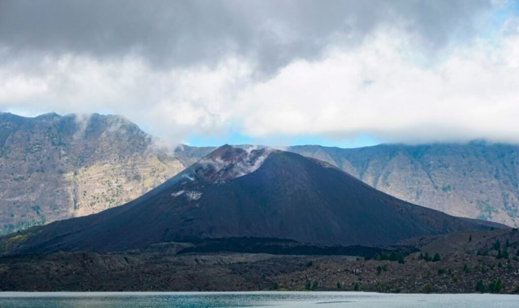
I heard from our guide that one night in 2009, Mount Rinjani erupted, spewing lava into the sky. Campers saw the flames shooting up and had to evacuate urgently. Many people might wonder, is climbing a volcano dangerous? What if it erupts?
In reality, active volcanoes are closely monitored and placed on an official “blacklist” for observation. They regularly release data and warnings. Unlike earthquakes, volcanic eruptions are rarely unpredictable; usually, signs of an impending eruption emerge several days in advance, leading to the closure of trails and a ban on climbing. Mountaineering companies also stay updated on these alerts, so following a guide generally ensures safety during the trek.
Our four-day, three-night itinerary included an overnight stay by the volcanic lake. Originally, our three-day, two-night trip didn’t plan for a campsite by the lake; instead, we were supposed to soak in hot springs and continue to the camping site at an elevation of 2,661 meters.
After climbing for an unknown amount of time, we finally caught a glimpse of the volcanic lake and the crater through the trees. The view was breathtaking, and the sight of the lake juxtaposed with the surrounding volcanic landscape made every bit of the climb worthwhile.
The eight-hour descent was a monotonous process, so I won’t go into too much detail; it was just a matter of walking and occasionally stumbling. Even though the ascent had its hardships, the scenic views ahead kept us motivated. On the way down, my mind felt blank, and I found myself daydreaming about returning to our luxurious hotel, where I could take a long shower, enjoy a massage, and relax comfortably. That thought definitely helped me quicken my pace!